
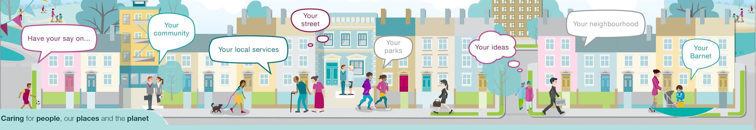
We asked, you said, we did
Find out more about the results of consultation and engagement activities and how we have used your views to help influence our decision-making process.
Find out more about the results of consultation and engagement activities and how we have used your views to help influence our decision-making process.
-
Proposed admission arrangements 2026/27, for Barnet community schools
Share Proposed admission arrangements 2026/27, for Barnet community schools on Facebook Share Proposed admission arrangements 2026/27, for Barnet community schools on Twitter Share Proposed admission arrangements 2026/27, for Barnet community schools on Linkedin Email Proposed admission arrangements 2026/27, for Barnet community schools linkRead more about this consultation
We asked
We asked for your views on the proposed reduction to the Published Admission Number (PAN) of Moss Hall Junior School, from 120 places to 90 places. The link feeder school, Moss Hall Infant, has already reduced its PAN from 120 to 90 places, in response to a fall in demand for places in recent years. The proposal to reduce Moss Hall Junior School’s PAN to 90 places would bring the junior school’s PAN in line with the infant school’s PAN.
You said
We received 12 responses. Approximately half of the respondents agreed with the proposal, citing that the reduction would better align the admission number with current demand. Furthermore, those in favour noted that the admission number could be increased if demand rises in the future, without the need for a further consultation process. A similar number of respondents disagreed with the reduction, expressing concerns that it would lead to increased congestion in neighbouring schools. A small number of respondents, two in total, neither agreed nor disagreed with the proposal.
We did
The PAN for Moss Hall Junior School has formally been reduced from 120 to 90 places, with effect from 1 September 2026. This will support financial planning and ensure the most efficient use of the school’s resources.
-
Danegrove Primary School and East Barnet School Street
Share Danegrove Primary School and East Barnet School Street on Facebook Share Danegrove Primary School and East Barnet School Street on Twitter Share Danegrove Primary School and East Barnet School Street on Linkedin Email Danegrove Primary School and East Barnet School Street linkRead more about this engagement
We asked
We asked for your views on the implementation of two ‘School Streets’ which is a controlled pedestrian and cycling zone during school pick up and drop off hours on the following roads:
- Windsor Drive (between Bohun Grove and Ridgeway Avenue)
- Chestnut Grove (between Daneland and Ridgeway Avenue)
The proposed times are 8.15-9.30am and 3.00-3.45pm Monday to Friday, term time only.
You said
We received 256 responses to this engagement with:
- 40.23% of respondents supportive of the measures.
- 50.39% of respondents opposed to the measures.
- 9.38% of respondents neither supportive nor opposed.
Further feedback included:
- 23.80% of respondents stated the scheme pushes traffic outside of the zone.
- 8.10% stated it should be extended to include Ridgeway Avenue.
- 8.57% of people stated they wanted to see alternative measures
- 4.76% stated proposals would impact their daily routines.
We did
Based on results from the engagement that showed a number of the respondents were concerned about traffic pushing onto their roads, we are looking at extending the School Street Zone.
The School Street Zone we are proposing will be Ridgeway Avenue between Cat Hill and Daneland, Chestnut Grove, Windsor Drive and Bohun Grove.
We will recommend that we launch the School Street Zone under an 18-month experimental basis. The first 6-months of which will include the statutory consultation.
Residents will be written to ahead of the School Street Zone, informing them of the measures and inviting them to share their views during the statutory consultation period.
-
New Southgate Recreation Ground – play equipment consultation
Share New Southgate Recreation Ground – play equipment consultation on Facebook Share New Southgate Recreation Ground – play equipment consultation on Twitter Share New Southgate Recreation Ground – play equipment consultation on Linkedin Email New Southgate Recreation Ground – play equipment consultation linkRead more about this consultation
We asked
We asked for your views on the proposed refurbishment of the upper playground at New Southgate Recreation Ground.
You said
We received 57 responses to the online questionnaire. The key themes from the public consultation were:
- Request for more baby swings.
- Request for small climbing frame/slide for younger children.
- Comments that the current red gates into the playground do not move well.
- Requests for water play.
- Request for a sand pit.
- Request for inground trampoline.
- Request for more seating and picnic tables.
- Pleased that the design allows all children to be included in the play area.
We did
The order has been placed for the new equipment, and this will be installed in early summer. This work is being funded by East Area Committee and by Greenspaces capital funding.
The basket swing has been removed, and in its place will be a baby seat, and a you and me seat, which allows a baby/small child and an adult to swing together.
There are two slides for young children, which can be accessed by the main slope and by a climbing slope.
The red gates into the playground will be replaced as part of this project.
We will not be providing water play as water features require regular water testing and maintenance on top of the general operating and utility costs, and the council does not have the funding for this.
We will not be providing a sand pit, as the council has no funding to maintain a sand pit. Sand pits require regular raking and topping up of sand. There is a sand pit at Market Place playground which was installed as a pilot project in September 2024. This is being maintained, and we are monitoring the time and cost of this work, before making any decisions on new sand features.
We will not be providing an inground trampoline. The ground underneath Barnet is London Clay, which means that the ground does not drain very well. Our experience is that the pit under a trampoline fills up with water and does not drain, even with a drainage system in place, which makes the trampoline unusable. The council is therefore not planning to install more trampolines.
The existing benches and picnic tables will remain. There is insufficient budget to provide more benches and tables as part of this project, but this will be considered as part of a wider park project.
-
Brunswick Park Road and Church Hill Road, road safety consultation
Share Brunswick Park Road and Church Hill Road, road safety consultation on Facebook Share Brunswick Park Road and Church Hill Road, road safety consultation on Twitter Share Brunswick Park Road and Church Hill Road, road safety consultation on Linkedin Email Brunswick Park Road and Church Hill Road, road safety consultation linkRead more about this engagement
We asked
We asked your views on our proposals to introduce a number of new road safety measures that will reduce the speed of vehicles and also aim to address concerns raised by residents in Brunswick Park Road, Church Hill Road and the surrounding area.
Amongst the measures proposed included a proposed 20 MPH zone, the introduction of new crossings, the upgrade of existing crossings, and the introduction of a southwest bound one-way system along Spencer Road.
You said
We received 226 responses from approximately 1635 properties, which equates to an overall response rate of 13.82%.
54.26% agreed that our proposals will improve road safety in the area, with 32.29% disagreeing.
Further feedback included:
- 52% of respondents supported our proposal to introduce a 20 MPH speed limit in the area.
- 62% of respondents supported our proposal to introduce junction improvements and a new crossing at Rushdene Avenue to link with Oak Hill Park.
- 72% of respondents supported our proposed upgrade of the existing zebra crossing outside Church Hill school.
- 69% of respondents supported our proposed upgrade of the current crossing on Brunswick Park between Prevost Road and Osidge Lane junction.
- 71% of respondents supported our proposed upgrade of the crossing on Osidge Lane.
- 63% of respondents supported our proposal to upgrade the zebra crossing near Benfleet Way.
- 65% of respondents supported our proposed introduction of double yellow lines in the area.
- 24% of respondents supported our proposal to introduce a one-way system on Spencer Road, with 40% opposing.
- 50% of respondents opposed our proposal to introduce speed cushions.
We did
Based on the results of the consultation, and taking into account all the comments received from residents, we are recommending introducing all proposed measures with the following amendments:
- Alter the 20 MPH speed limit proposal to only include Church Hill Lane and exclude Brunswick Park Road.
- The decision to progress with the 20 MPH speed limit proposal on Church Hill Lane is due to the presence of Church Hill School, Oak Hill School, St Mary’s East Barnet Church and Oak Hill Park, and to ensure safety for their vulnerable (children and the elderly) users.
- Incorporate “except cyclist” within the one-way restrictions along the proposal.
- Review the location and number of speed calming measures to maximise their effectiveness as complementary measures within the proposals.
We will also recommend a further review take place in the future for further measures highlighted by residents on Brunswick Avenue and Brunswick Gardens.
-
Childs Hill Primary School Street
Share Childs Hill Primary School Street on Facebook Share Childs Hill Primary School Street on Twitter Share Childs Hill Primary School Street on Linkedin Email Childs Hill Primary School Street linkRead more about this engagement
We asked
We asked for your views on the live ‘School Street’ which is a controlled pedestrian and cycling zone during school pick up and drop off hours on the following roads:
Dersingham Road between Cricklewood Lane and Somerton Road
Whole of Caddington Road
The proposed times are 8.15-9.15am and 3.00-4.00pm Monday to Friday, term time only.
You said
We received 130 responses to this engagement. This included 51 pupil / parent responses, 47 through Engage Barnet responses and 32 responses via email:
45.38% of respondents supported the measures.
34.62% of respondents opposed the measures.
10% of respondents neither support nor opposed.
10% of respondents was general questions and enquiries.
Only adult responses were analysed in terms of themes. This showed:
30% of respondents stated it impacted parking in the surrounding area.
19% of respondents stated it pushes congestion and traffic onto neighbouring roads.
22% of respondents stated it made the area much quieter and safer.
We did
Based on the feedback received and having reviewed the traffic counts and parking stress surveys, officers have decided to make the School Street permanent. We will also look to make pre-warning signage larger and consider further parking restrictions at key junctions in the area.
-
Burnt Oak North (BON) - Experimental Controlled Parking Zone Extension
Share Burnt Oak North (BON) - Experimental Controlled Parking Zone Extension on Facebook Share Burnt Oak North (BON) - Experimental Controlled Parking Zone Extension on Twitter Share Burnt Oak North (BON) - Experimental Controlled Parking Zone Extension on Linkedin Email Burnt Oak North (BON) - Experimental Controlled Parking Zone Extension linkRead more about this engagement
We asked
We asked for your views on our minor amendments to the Burnt Oak North (BON) Controlled Parking Zone (HA8) in order to address local parking concerns.
You said
We received 13 responses from approximately 3344 properties, which equates to an overall response rate less than 1%. As the changes made were minor in its capacity, this level of response was anticipated.
2 respondents objected to the minor amendments directly. 11 respondents either sent an enquiry, objected to the scheme as a whole or responded to the update emails that were sent relating to measures that were previously implemented.
We did
Based on the feedback received we will be making the minor amendments permanent on 24 February 2025.
The minor experimental amendments being made permanent are:
- existing shared use bays in Orange Hill Road, Deansbrook Road, Watling Avenue, Grange Road and Fortescue Road changed from ‘Resident permit holders and Pay by Phone’ to ‘Permit holders and Pay by Phone’.
- shared use bay outside no. 35 Abbots Road.
- single yellow line within a parking bay in Orange Hill Road, which operates between 8am to 9.30am and 3pm to 4.30pm
- loading bay (Mon-Fri 8am-6.30pm) in Deansbrook Road outside the parade of shops
- double yellow lines and inclusion of North Road Estate and Brearley Close into the BON CPZ.
The proposed double yellow lines in Market Lane have not been implemented, however this will be reviewed at a later date.
We have written to residents detailing the outcome of this consultation. You can read this letter here.
-
Economic Development Framework engagement - Phase 1
Share Economic Development Framework engagement - Phase 1 on Facebook Share Economic Development Framework engagement - Phase 1 on Twitter Share Economic Development Framework engagement - Phase 1 on Linkedin Email Economic Development Framework engagement - Phase 1 linkRead more about this engagement
We asked
Barnet wants to refresh its economic development strategy with a new framework that responds to current and future challenges and opportunities and aligns with the priorities outlined in Our Plan for Barnet.
We wanted to hear from residents, businesses and communities on your challenges, priorities and ideas on how the council can better support the local economy and attract more people and businesses to Barnet.
You said
During public engagement (8 July to 18 August 2024) we had 770 page views and 512 unique visitors to our Engage Barnet page. 50+ people attended one of seven workshops (three for residents and businesses, two for young people (Barnet Youth Board), two for voluntary sector. Further engagement was held with council services, strategic partners and key business sectors such as arts and culture, construction and health and social care.
A questionnaire attracted 106 responses (random sample) with responses from residents (78%), business owners (7%), workers (7%) and charities (5%).
Engagement comments were grouped thematically and ranked by frequency. Our findings:
Barnet’s strengths to build on:
- Diversity: of businesses and people in the borough
- Businesses: local and independent
- Green: lots of space and parks
- Community: spirit and participation
- Education: strong schools and highly educated residents
- Transport: connectivity into central London
Barnet’s weaknesses to address:
Infrastructure: lack of investment, potholes
Shops: low quality and few independents
Transport: moving across the borough, inconvenient
High street: cluttered and unattractive, greedy landlords
Workspace: offices disappearing for homes
Poverty: pockets of deprivation, run down neighbourhoods
Connectivity: Wi-Fi and mobile coverage
Council: comms not reaching people, website hard to use
Young people: few leisure choices or career development options
We did
We are drafting an economic development framework (EDF) for the next five years that responds to these comments and the economic evidence base that illustrates Barnet’s economic strengths and weaknesses.
Barnet’s economy is affected by London and the UK and vice versa. A London Growth Plan is due for publication in 2025 and UK Government strategies on key business sectors and on welfare, skills and employment reform are all being developed. Barnet inputs into to these initiatives, contributing intelligence from engagement completed above. The EDF will take London and national needs and priorities into account in its content.
The EDF will also meet Barnet Council’s corporate ambitions of tackling inequalities and reducing poverty, growing local wealth. These priorities are informed by a better understanding of how growth is experienced in the borough and its effect on residents, businesses and communities.
This is why community wealth building is central. We’ll focus on those most in need, least well served by the economy. The council can’t do this work alone. Its approach is to work in partnership to have impact at scale and pace.
The council will use its unique position to bring this about, but this is an economic development framework for the borough and all its economic stakeholders to deliver together.
We will consult on a revised Economic Development Framework in March 2025 and it is expected to go to Cabinet in Summer 2025 for public scrutiny.
-
Connecting Colindale - Area C
Share Connecting Colindale - Area C on Facebook Share Connecting Colindale - Area C on Twitter Share Connecting Colindale - Area C on Linkedin Email Connecting Colindale - Area C linkRead more about this engagement
We asked
We asked for your views on one scheme proposals within Area C. We asked for whether residents thought that the schemes would improve public spaces and improve active routes around Area C.
You Said
We received 58 responses to this engagement.
C1: Peel Link Connection
- 60% of respondents agreed that this would improve public spaces and improve active routes around Area C
- Concerns about crime and antisocial behaviour
- Potential issues with parking from commuters/ non-residents
- Improve the existing short-cut with timber bridge which suffers from flooding and fly tipping
We did
- The proposed link be lit with CCTV provided and overgrown vegetation trimmed.
- If parking is identified as an issue following implementation, the Council will consult on local parking controls w.
- The current proposal is to provide a permanent direct, safe and accessible link to serve communities to the north and south of the rail line.
-
Connecting Colindale - Area B
Share Connecting Colindale - Area B on Facebook Share Connecting Colindale - Area B on Twitter Share Connecting Colindale - Area B on Linkedin Email Connecting Colindale - Area B linkRead more about this engagement
We asked
We asked for your views on five scheme proposals within Area B. We asked for whether residents thought that the schemes would improve public spaces and improve active routes around Area B.
You Said
We received 23 responses to this engagement.
B1. Colindale Avenue corridor improvements: Pasteur Close to Roundabout
- 78% of respondents agreed that this would improve public spaces and improve active routes around Area B
B2. Colindale Avenue corridor improvements: A5 to Colindale Station
- 83% of respondents agreed that this would improve public spaces and improve active routes around Area B
- Concern over the lack of controlled crossings at Colindale Avenue/ Edgware Road
B3. Aerodrome Roundabout enhancement
- 78% of respondents agreed that this would improve public spaces and improve active routes around Area B
- Concerns about flooding on the Aerodrome roundabout
B4. Aerodrome Roundabout enhancement
- 78% of respondents agreed that this would improve public spaces and improve active routes around Area B
B5. RAF Museum entrance
- 78% of respondents agreed that this would improve public spaces and improve active routes around Area B
Area B General Comments
- Poor surface quality, narrow footway
- Narrow width of bridge outside Colindale Station resulting in overcrowding on footway.
We did
B2. Colindale Avenue corridor improvements: A5 to Colindale Station
- The Council is delivering a separate scheme to improve crossing facilities at the A5 junction.
B3. Aerodrome Roundabout enhancement
- Surface flooding will be managed on the roundabout using sustainable drainage systems to provide additional capacity.
Area B General Comments
Footways will be resurfaced and widened on the northern side to improve access to the Colindale Station
-
Connecting Colindale - Area A
Share Connecting Colindale - Area A on Facebook Share Connecting Colindale - Area A on Twitter Share Connecting Colindale - Area A on Linkedin Email Connecting Colindale - Area A linkRead more about this engagement
We asked
We asked for your views on six scheme proposals within Area A. We asked for whether residents thought that the schemes would improve public spaces and improve active routes around Area A
You Said
We received 29 responses to this engagement.
A1. Improved walking routes: Bristol Avenue to Blundell Road and Lanacre Avenue
- 83% of respondents agreed that this would improve public spaces and improve active routes around Area A
- Important to consider safety for those using the park at night linking to Colindale Station
- Improved surfacing, lighting and landscaping will be welcome.
A2. Watford Way pedestrian connection
- 66% of respondents agreed that this would improve public spaces and improve active routes around Area A
- Route may be potentially longer than on Aerodrome Rd
- Is there CCTV proposed in underpass?
- Poor quality of pedestrian footways in the area
A3. Booth Road traffic calming
- 72% of respondents agreed that this would improve public spaces and improve active routes around Area A
- Suggest extending 20mph on all of North and south Colindale
- Booth Road is not too busy and doesn’t require traffic calming which may displace traffic to nearby streets.
- Traffic calming will not be observed by drivers
A4. Heybourne Park to Montrose Park Walk
- 72 % of respondents agreed that this would improve public spaces and improve active routes around Area A
- Potential Issues with antisocial behaviour in Montrose Park if linked to Heybourne Park
A5. Walking and cycling link to Mill Hill Broadway (East - West)
- 55% of respondents agreed that this would improve public spaces and improve active routes around Area A
- High levels of traffic on Bunns Lane
- Step-free access at Mill Hill Broadway Station required
- Consider direct bus services from Colindale to Mill Hill Broadway.
A6. Walking and Cycling link to Mill Hill Broadway (North-South)
- 52 % of respondents agreed that this would improve public spaces and improve active routes around Area A
We did
A1. Improved walking routes: Bristol Avenue to Blundell Road and Lanacre Avenue
- Existing lighting to be upgraded where appropriate subject to funding
- Footways will be resurfaced, and landscape features introduced to improve drainage and make the route pleasant.
A2. Watford Way pedestrian connection
- The proposal will improve an existing link which feels isolated and overlooked.
- CCTV and lighting will be investigated in the subway subject to funding
- Footway Improvements and trimming of overgrown hedges proposed outside subways.
A3. Booth Road traffic calming
- The introduction of an area-wide 20mph speed limit is outside the scope of this project.
- Booth Road serves as an alternative route for the A5 although it is a residential street. Traffic surveys indicate that Booth Road receives about 5,000 vehicles a day.
- We will provide suitable traffic calming features with appropriate spacing that will encourage compliance.
A4. Heybourne Park to Montrose Park Walk
- We will trim back overgrown hedges and upgrade lighting to improve personal safety.
A5. Walking and cycling link to Mill Hill Broadway (East - West)
- We will widen footways on Bunns Lane to provide a shared use facility for pedestrians and cyclists
- Works within the station is outside the scope of this project.
- Bus services are managed by Transport for London who have been consulted on the proposals.